Log in
All resources
Create a design
35,787 Free Images of 1815 Maps
charts and maps of the royal museums greenwich
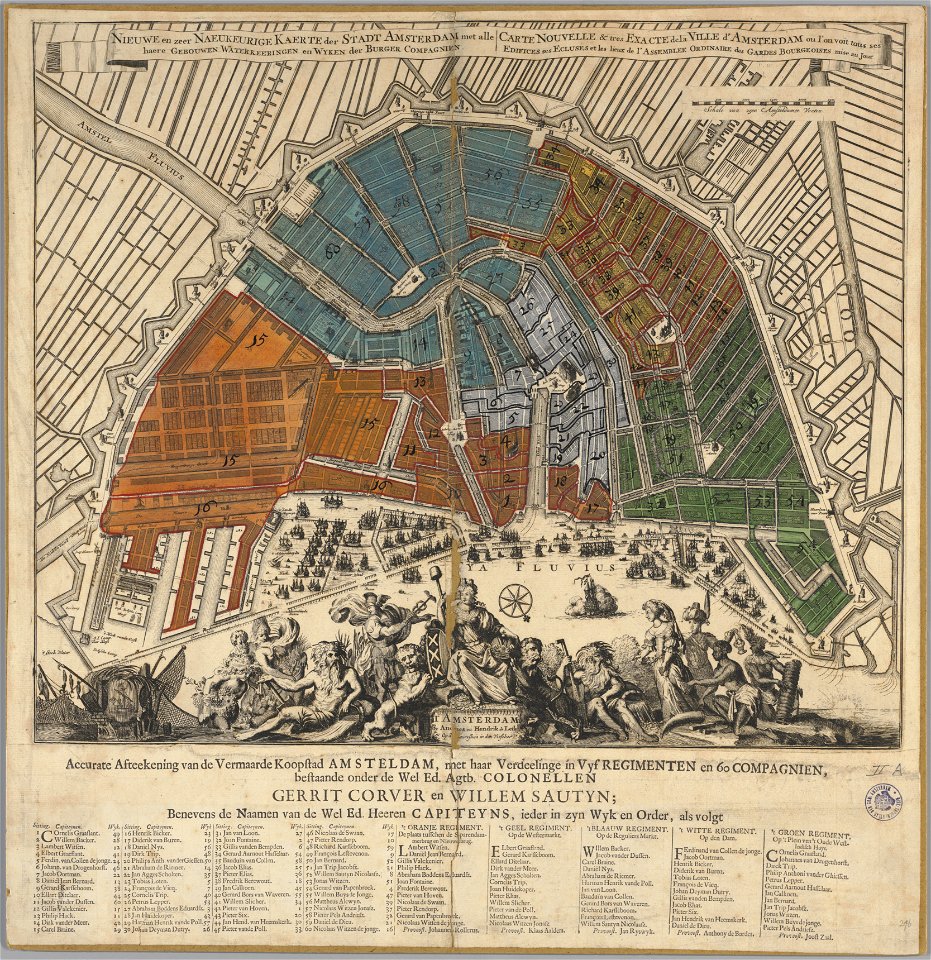
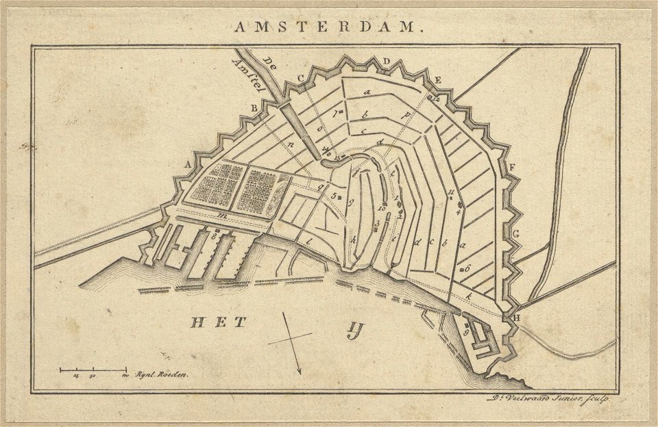
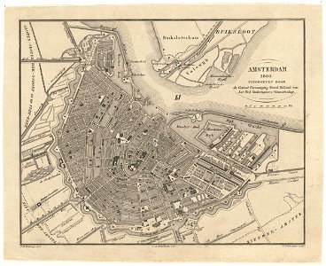
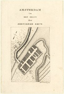
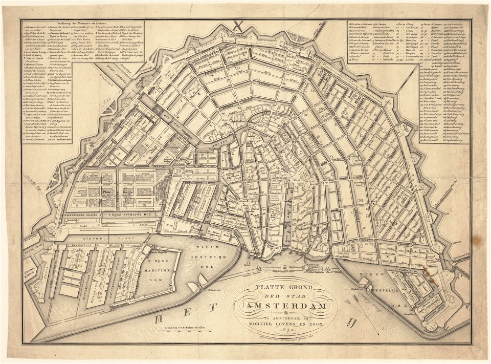
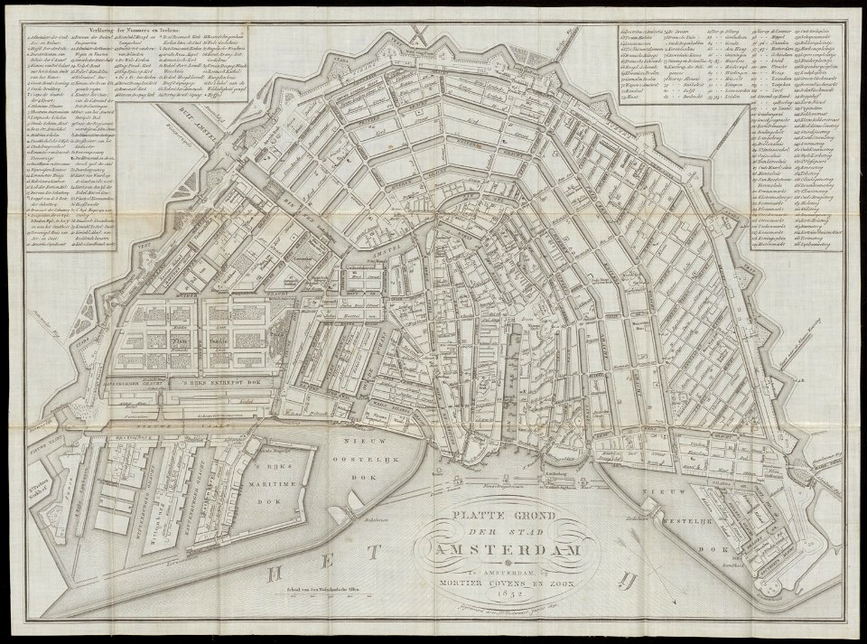
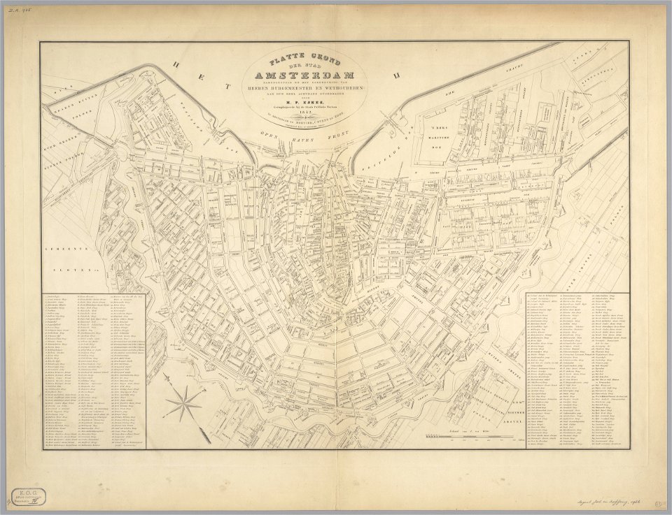
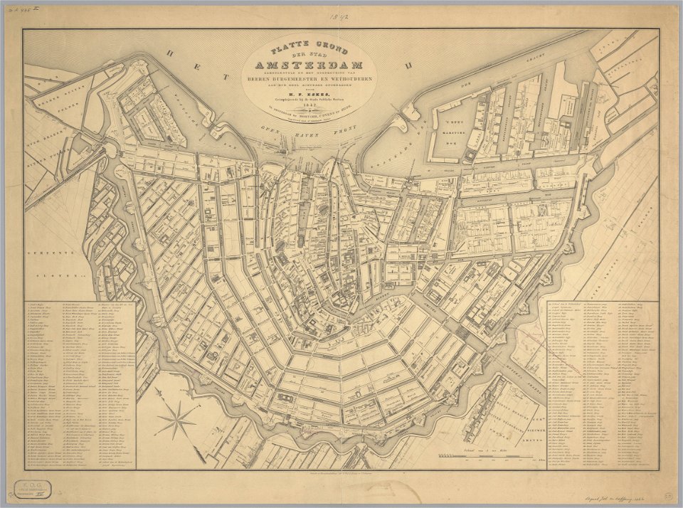
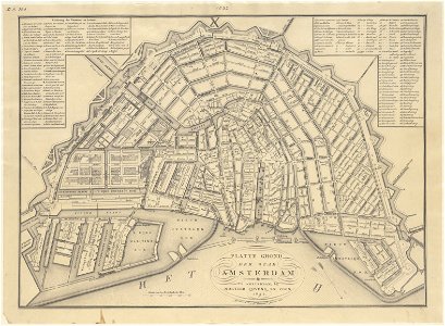
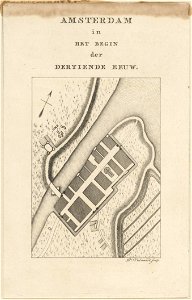
maps in the stadsarchief amsterdam
daniël veelwaard (i)
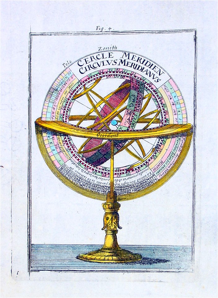
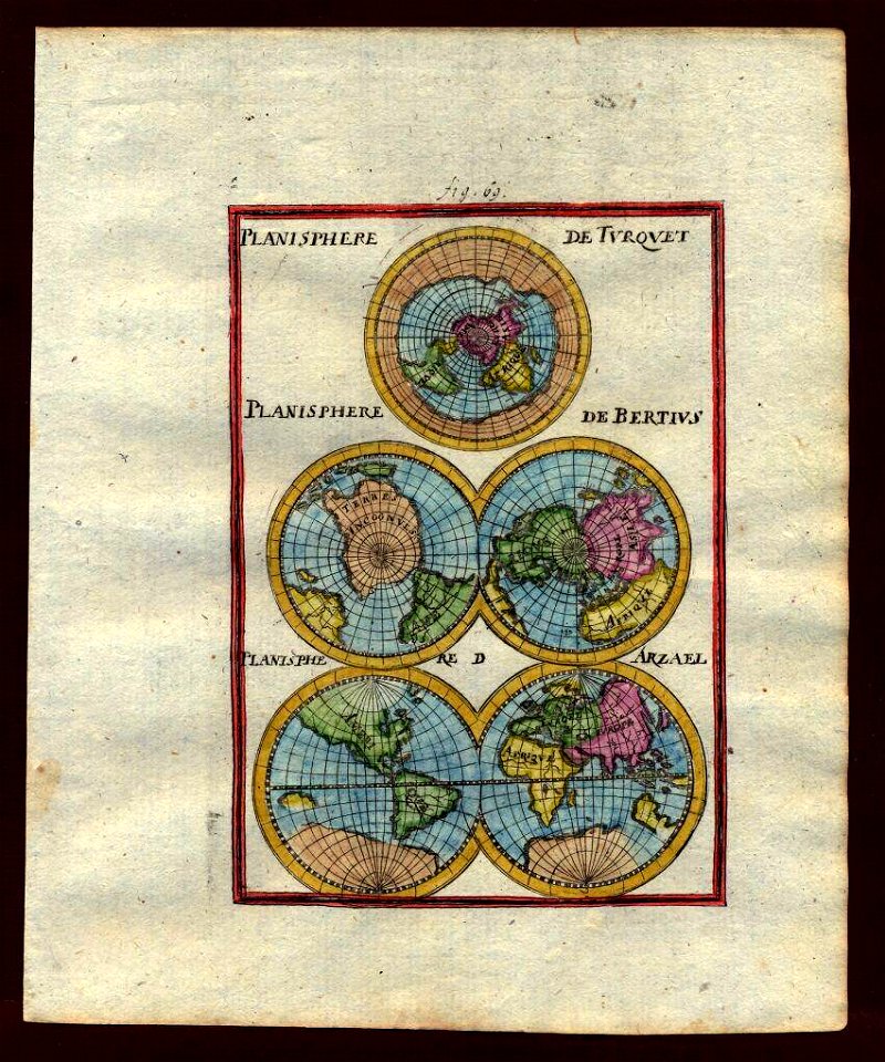
description de l'universe
hendrik de leth
atlas de wit 1698
1710s maps of the world
1680s maps of the world
atlante veneto (raremaps.com) volume 2
karl spruner von merz
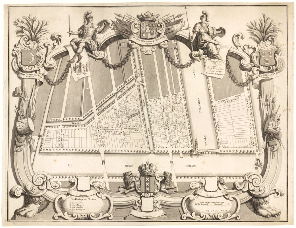
maps in the stadsarchief amsterdam
hendrik de leth
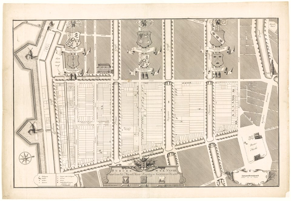
maps in the stadsarchief amsterdam
hendrik de leth
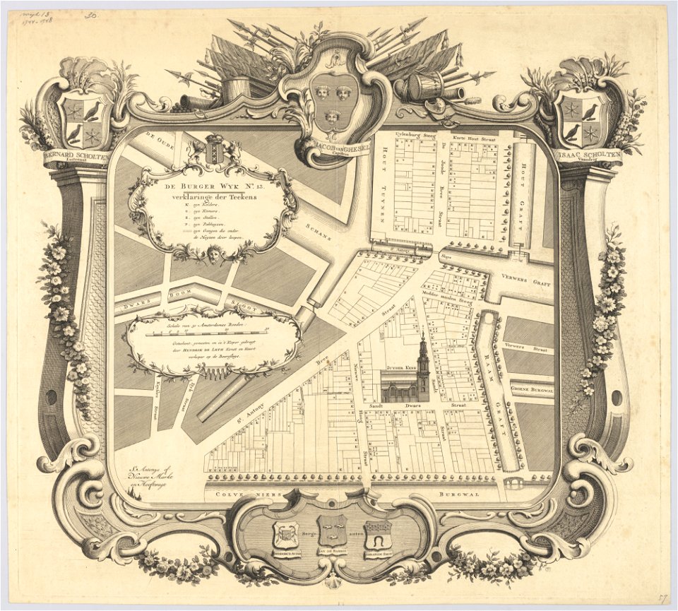
maps in the stadsarchief amsterdam
hendrik de leth
maps in the stadsarchief amsterdam
hendrik de leth
maps in the stadsarchief amsterdam
hendrik de leth
maps in the stadsarchief amsterdam
hendrik de leth
encyclopaedia universalis mundaneum
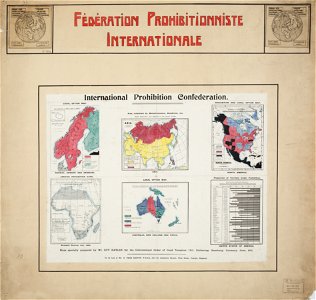
alcohol prohibition
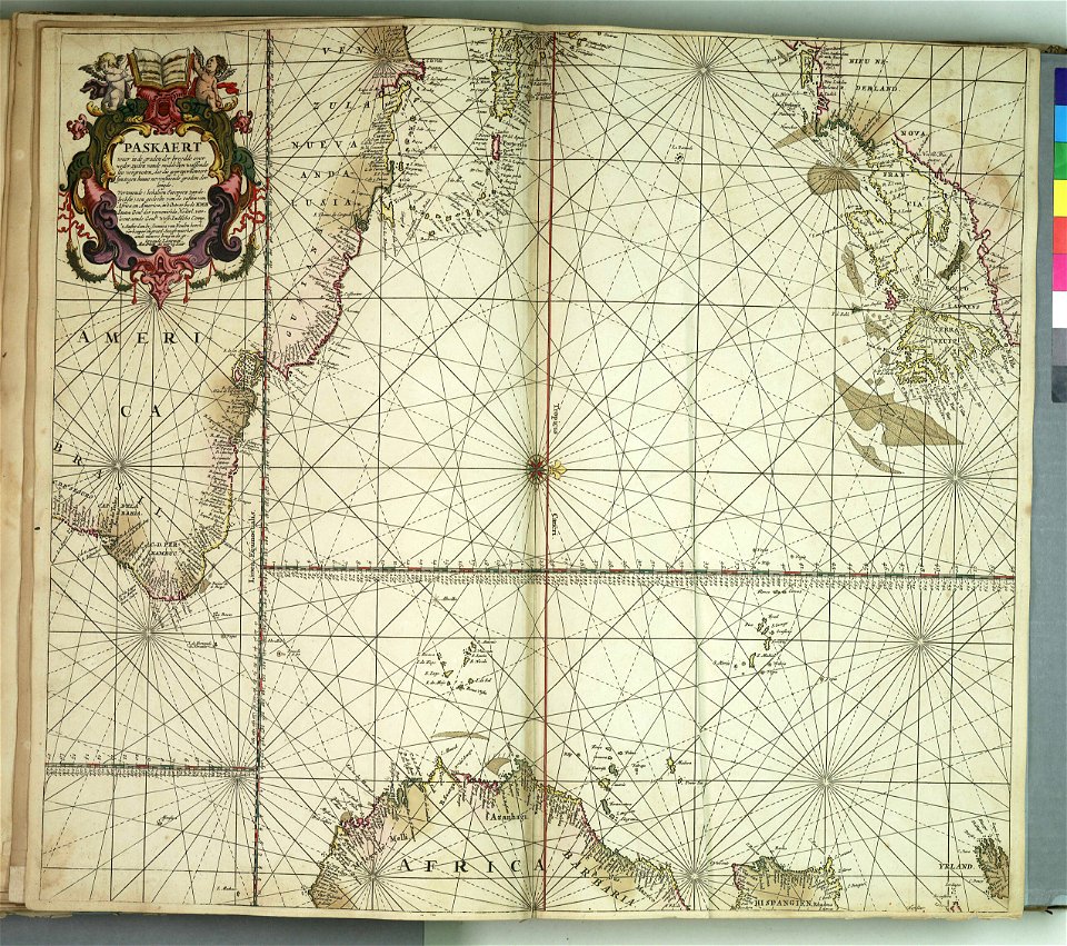
charts and maps of the royal museums greenwich
charts and maps of the royal museums greenwich
charts and maps of the royal museums greenwich
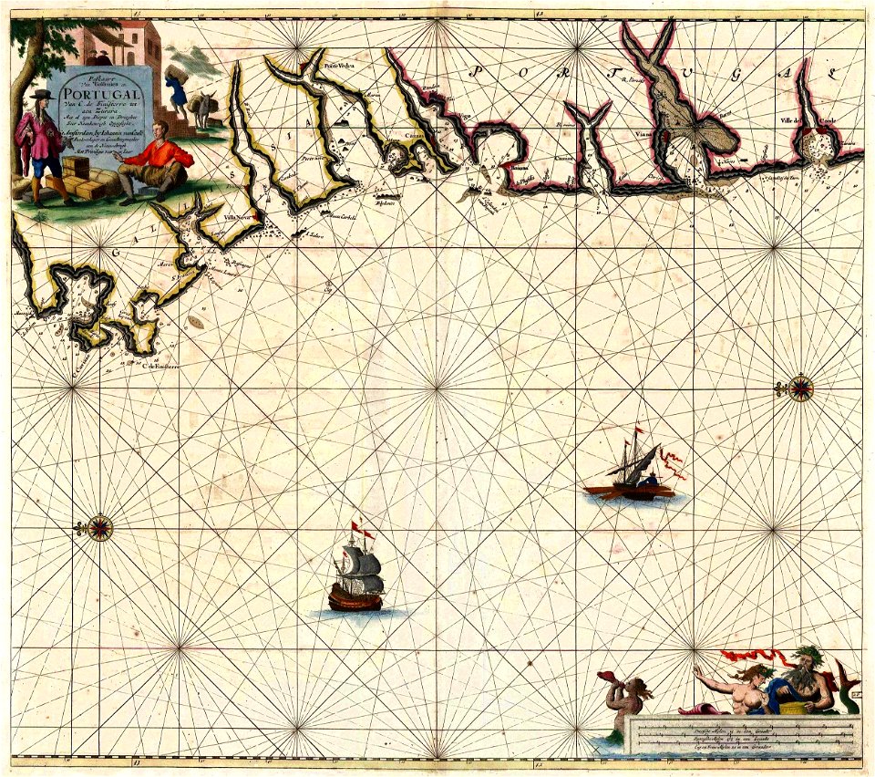
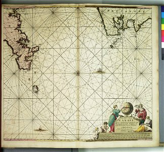
old maps of galicia (spain)
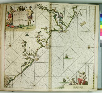
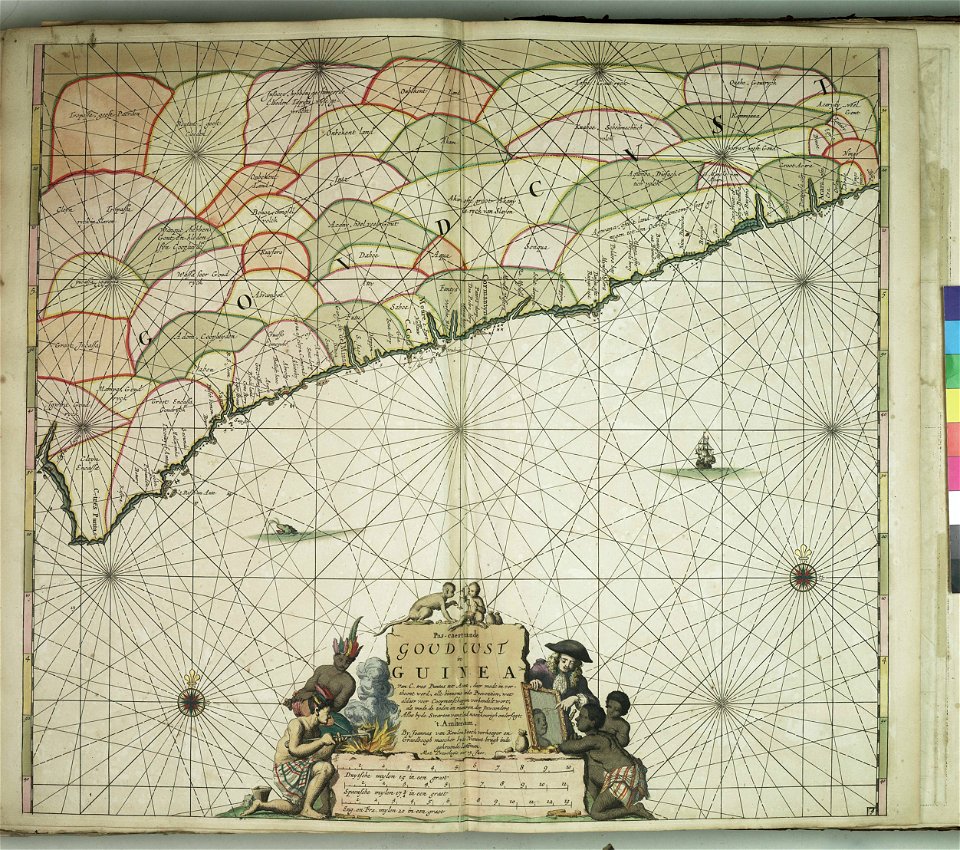
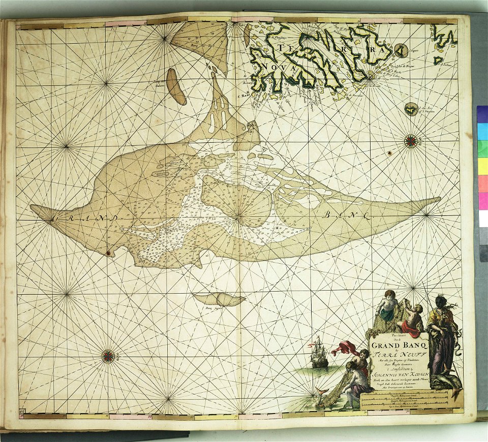
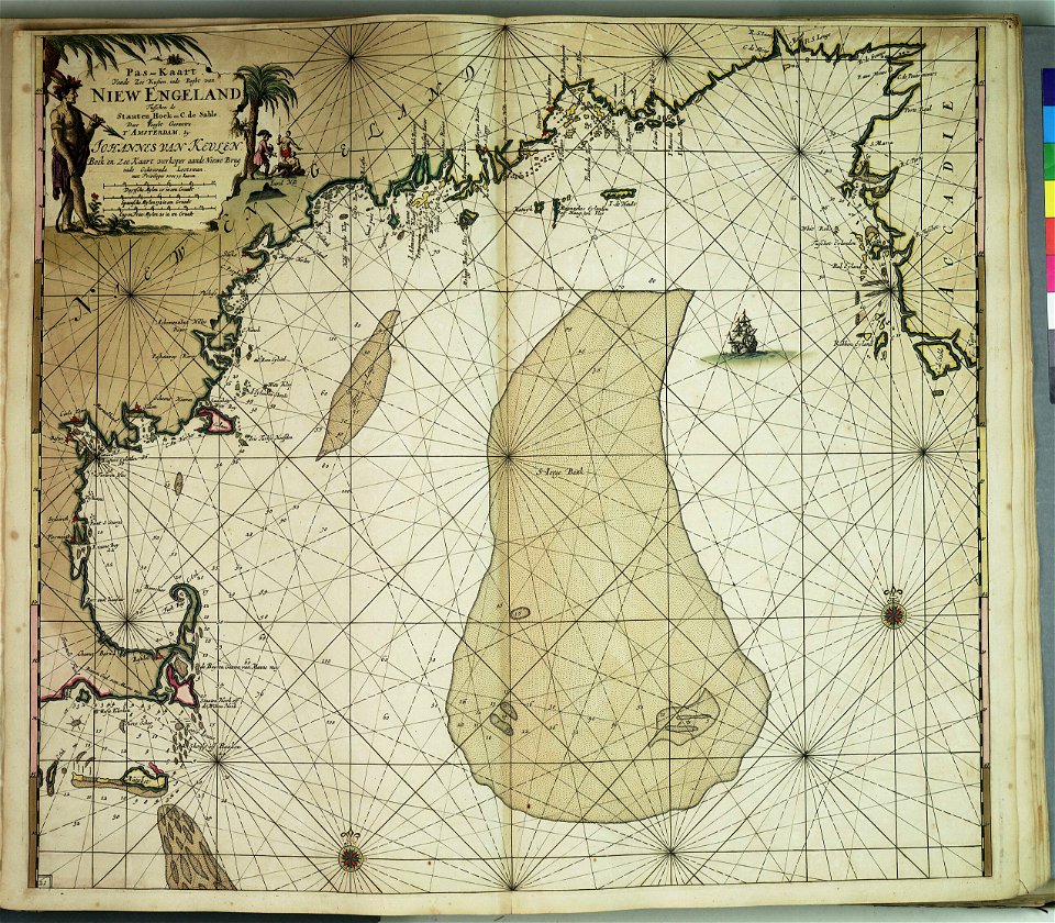
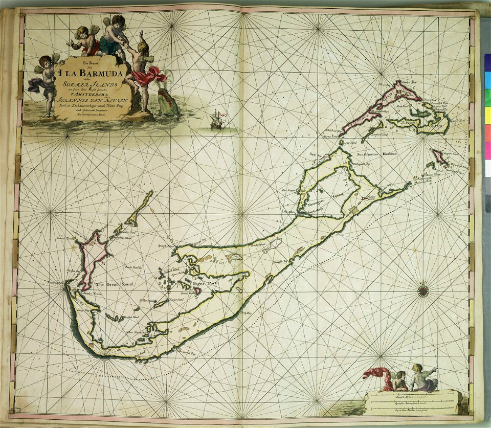
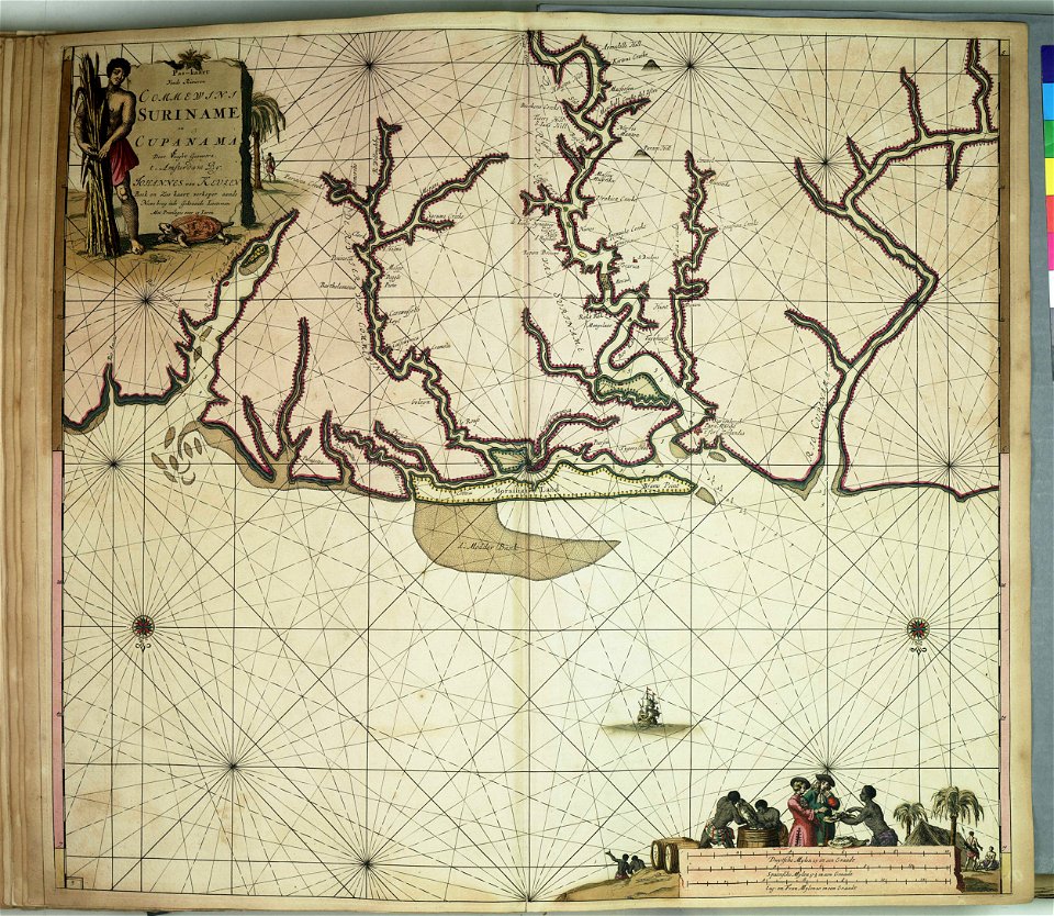
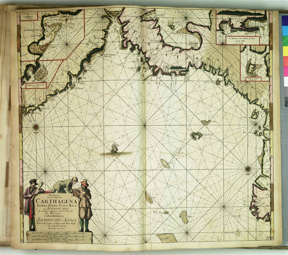
johannes van keulen
charts and maps of the royal museums greenwich
charts and maps of the royal museums greenwich
charts and maps of the royal museums greenwich
charts and maps of the royal museums greenwich
charts and maps of the royal museums greenwich
charts and maps of the royal museums greenwich
charts and maps of the royal museums greenwich
charts and maps of the royal museums greenwich
charts and maps of the royal museums greenwich
popular science monthly illustrations/volume 11
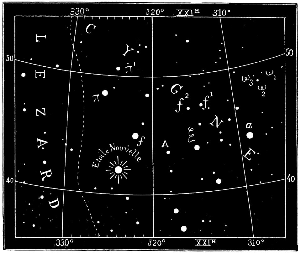
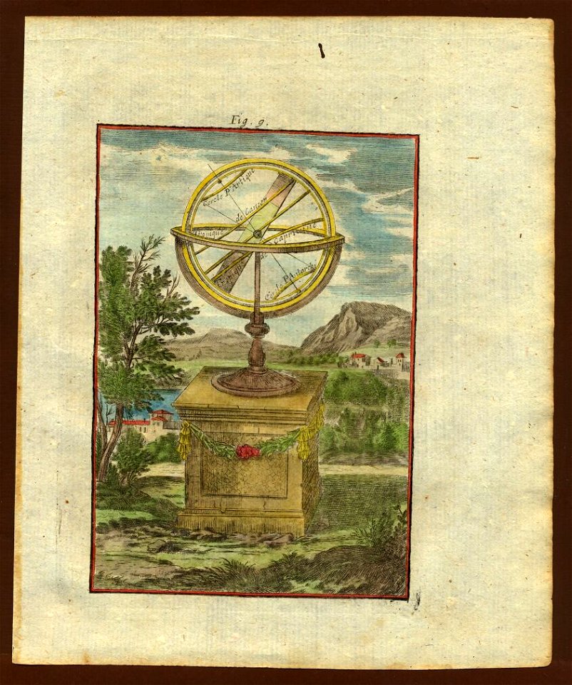
astronomical maps
description des principales villes (1690)
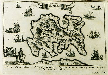
maps of bozcaada
charts and maps of the royal museums greenwich
charts and maps of the royal museums greenwich
charts and maps of the royal museums greenwich
charts and maps of the royal museums greenwich
charts and maps of the royal museums greenwich
charts and maps of the royal museums greenwich
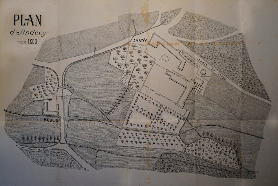
abbaye d'andecy
1890 in marne
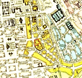
parts of old maps of berlin
königliche hauptbank
description de l'universe
1710s maps of the world
description de l'universe
1680s maps of the world
description de l'universe
1710s maps of the world
description de l'universe
1680s maps of the world
description de l'universe
1710s maps of the world
description de l'universe
1680s maps of the world
description de l'universe
old maps of the world
itinerarium hierosolymitanum et syriacum..., 1619
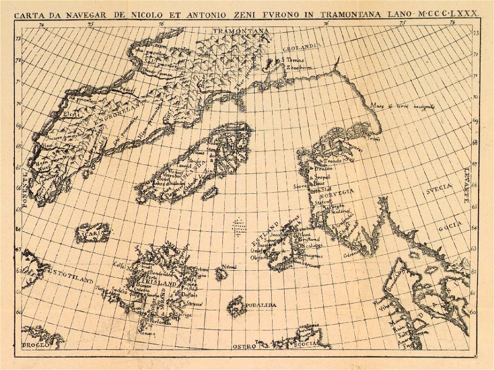
ships on maps
maps in the stadsarchief amsterdam
daniël veelwaard (i)
maps in the stadsarchief amsterdam
daniël veelwaard (i)
maps in the stadsarchief amsterdam
daniël veelwaard (i)
maps in the stadsarchief amsterdam
daniël veelwaard (i)
maps in the stadsarchief amsterdam
daniël veelwaard (i)
maps in the stadsarchief amsterdam
daniël veelwaard (i)
maps in the stadsarchief amsterdam
daniël veelwaard (i)
maps in the stadsarchief amsterdam
daniël veelwaard (i)
maps in the stadsarchief amsterdam
daniël veelwaard (i)
maps in the stadsarchief amsterdam
daniël veelwaard (i)
maps in the stadsarchief amsterdam
daniël veelwaard (i)
description de l'universe
1680s maps of the world
description de l'universe
1710s maps of the world
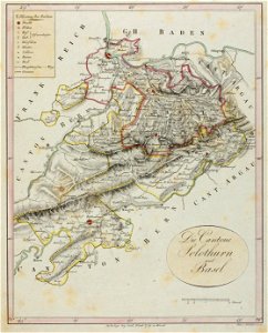
historical images of solothurn
old maps of switzerland
johannes van keulen
zuiderzeemuseum
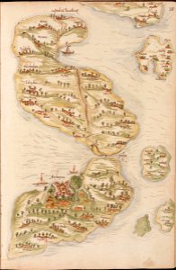
old maps of valletta
joan blaeu
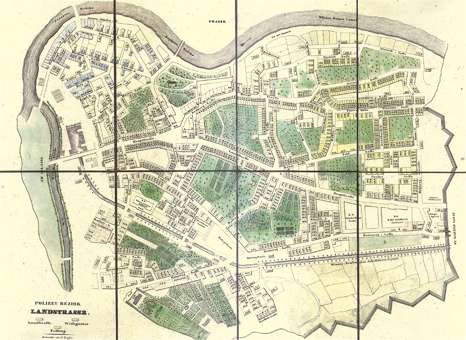
old maps of landstraße (vienna)
carl graf vasquez
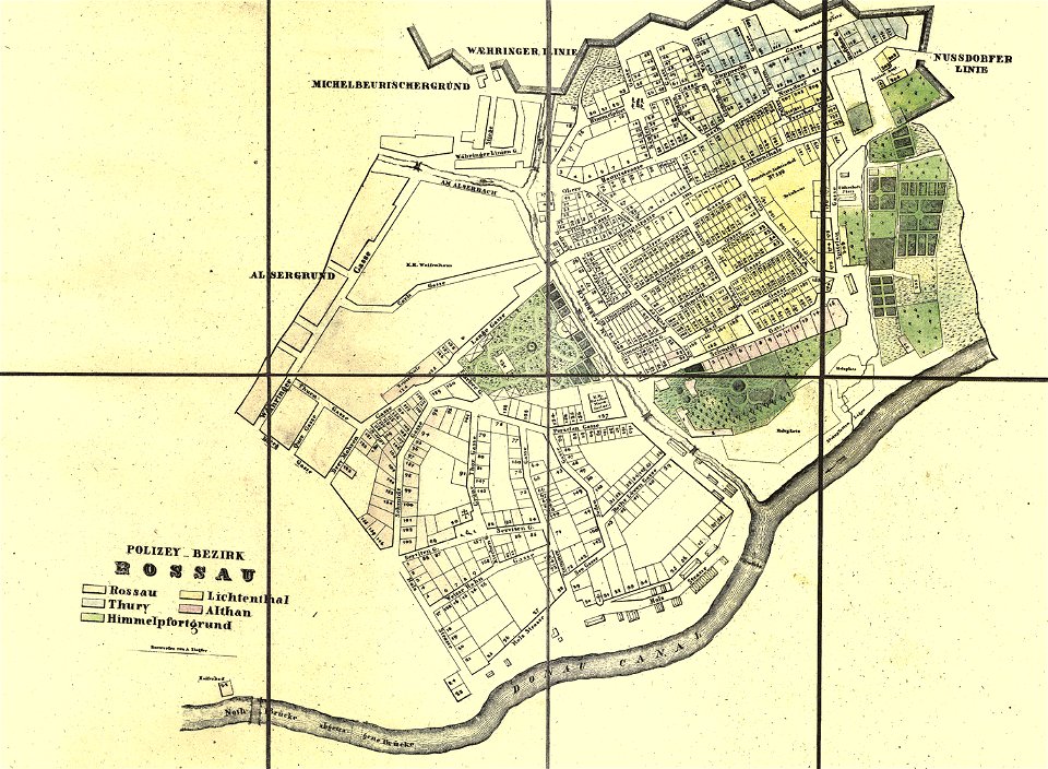
old maps of alsergrund
carl graf vasquez
maps in the library of congress
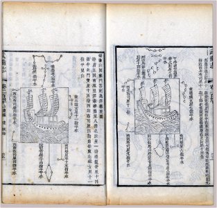
wubei zhi
maps in the library of congress
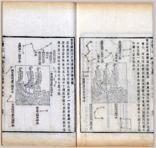
wubei zhi
provided by landsbókasafn íslands
old maps of iceland
maps by gustav adolf von varendorf
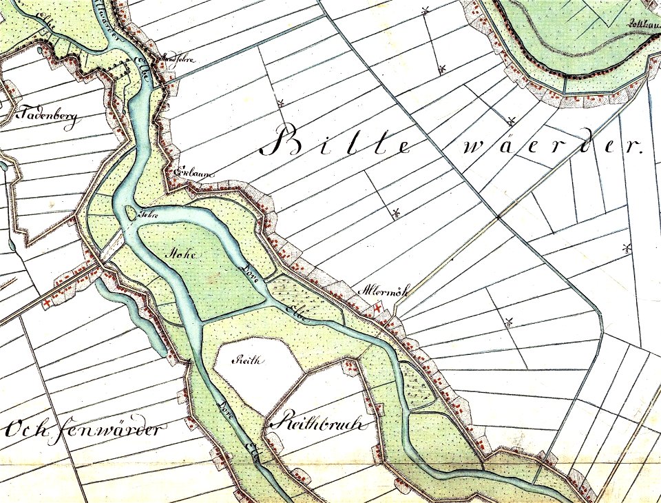
dove elbe
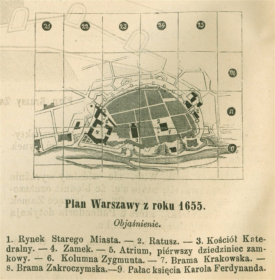
historical maps of warsaw
warsaw in the 1650s
viceroyalty of peru
1646
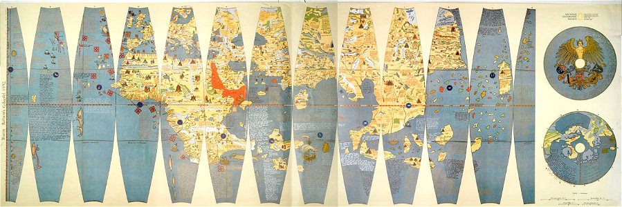
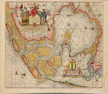
atlante veneto (raremaps.com) volume 1
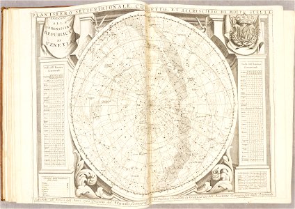
old celestial maps
atlante veneto (raremaps.com) volume 2
maps of lefkada
atlante veneto (raremaps.com) volume 2
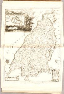
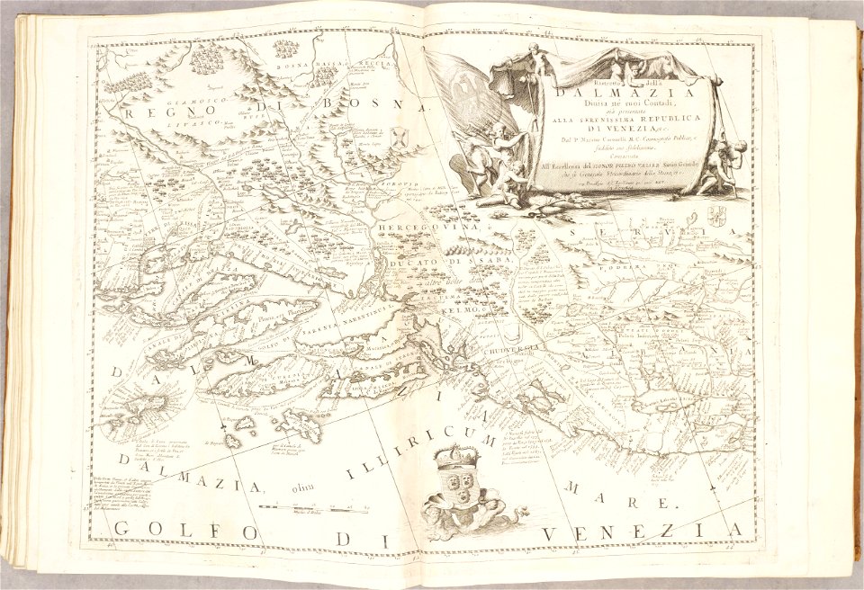
maps of dalmatia
atlante veneto (raremaps.com) volume 2
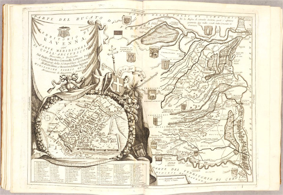
maps of ravenna
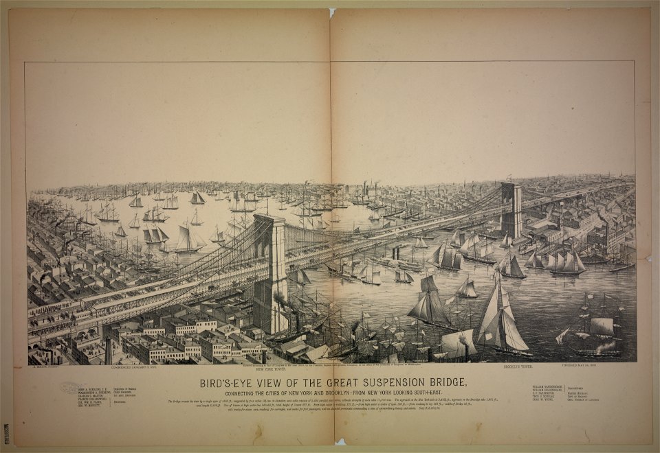
bird's eye view maps of new york city
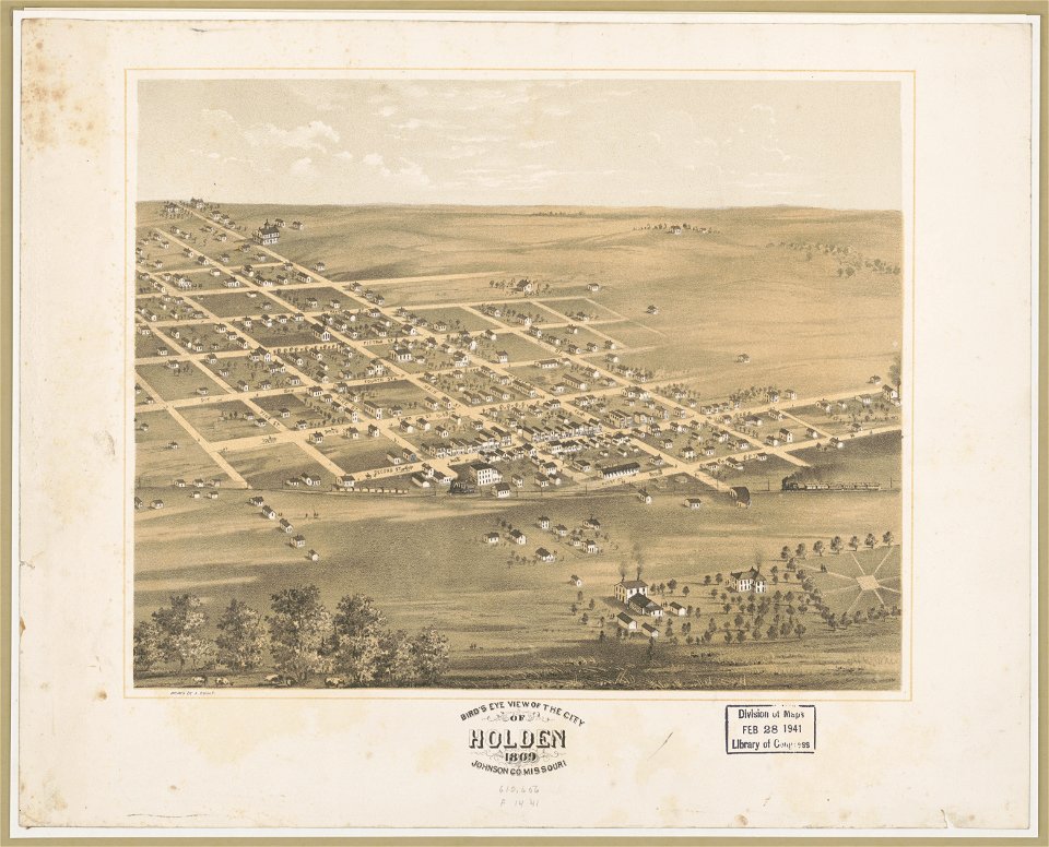
bird's eye view maps of missouri
albert ruger
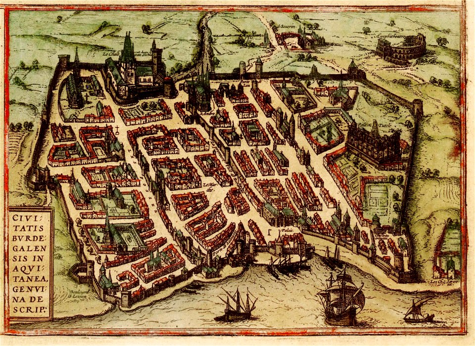
old maps of bordeaux
braun & hogenberg
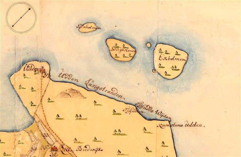
stora- och lilla bergholmen
strömsö
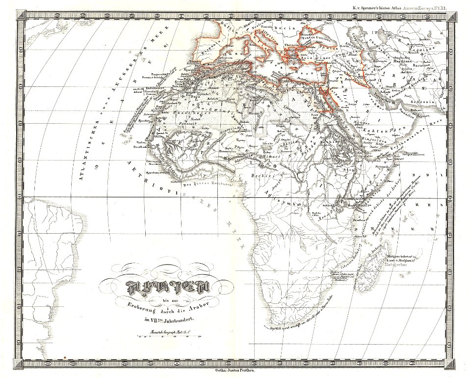
karl spruner von merz
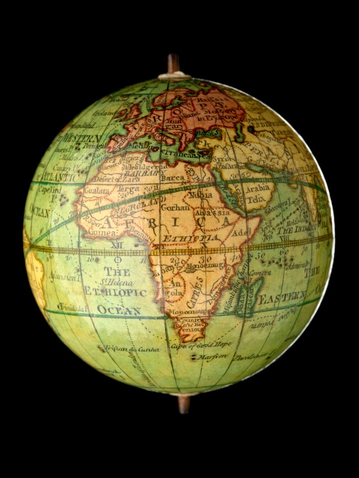
1855 maps of africa
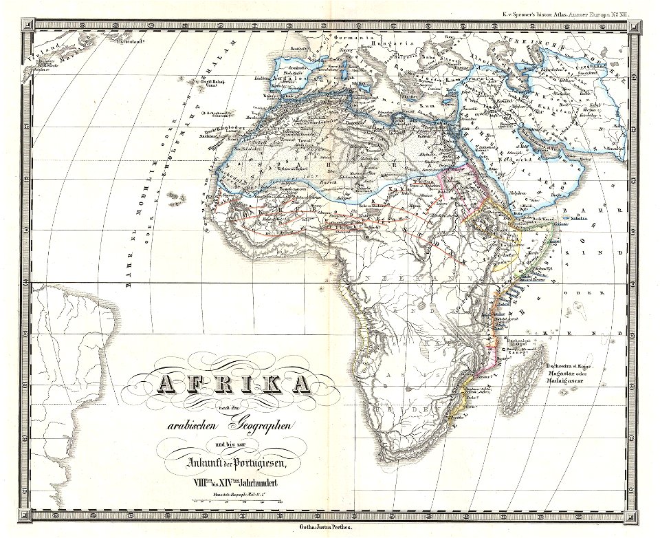
karl spruner von merz
1855 maps of africa
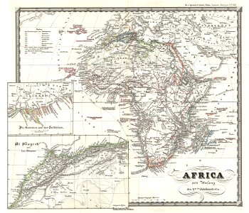
karl spruner von merz
1855 maps of africa
sherwood studio building
maps of new york city
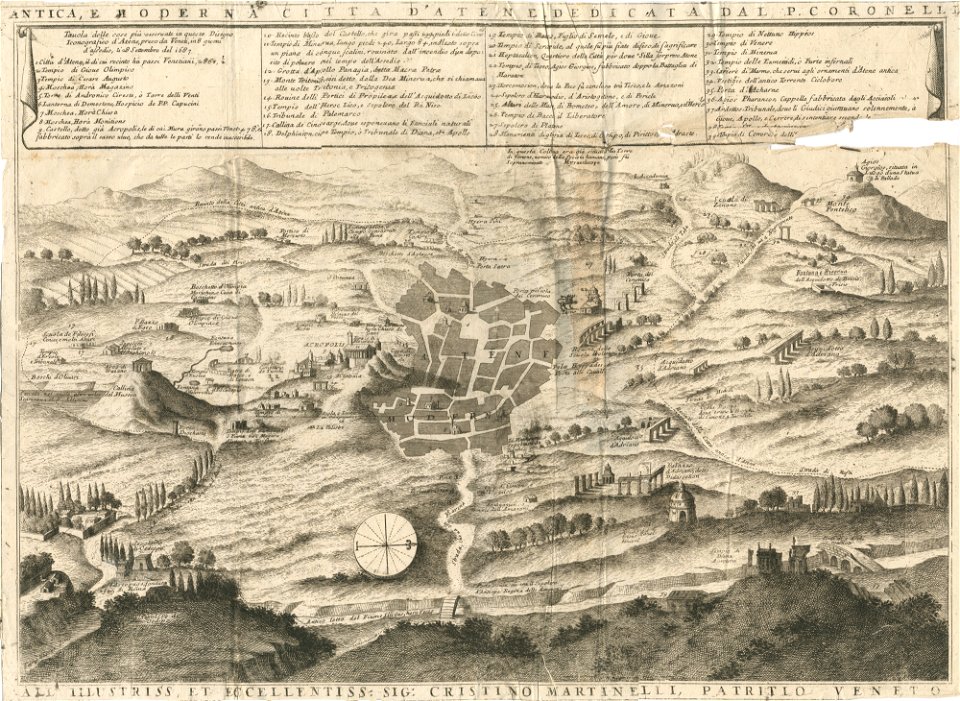
geographical illustrations by coronelli
old maps of athens
geographical illustrations by coronelli
old maps of athens
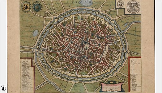
maps of bruges by jan blaeu
flandria illustrata
description des principales villes (1690)
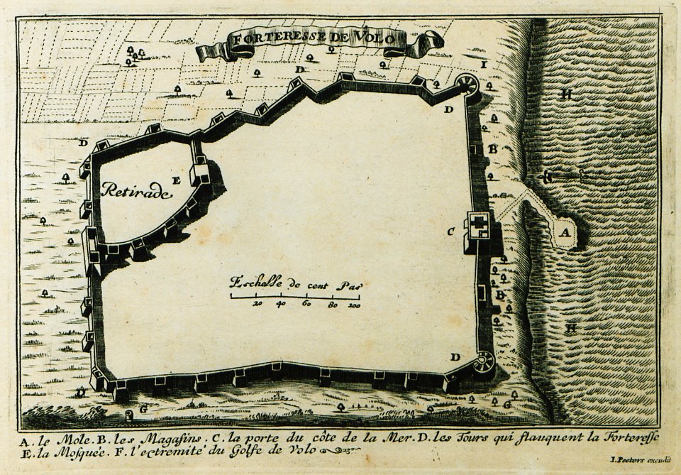
maps of volos
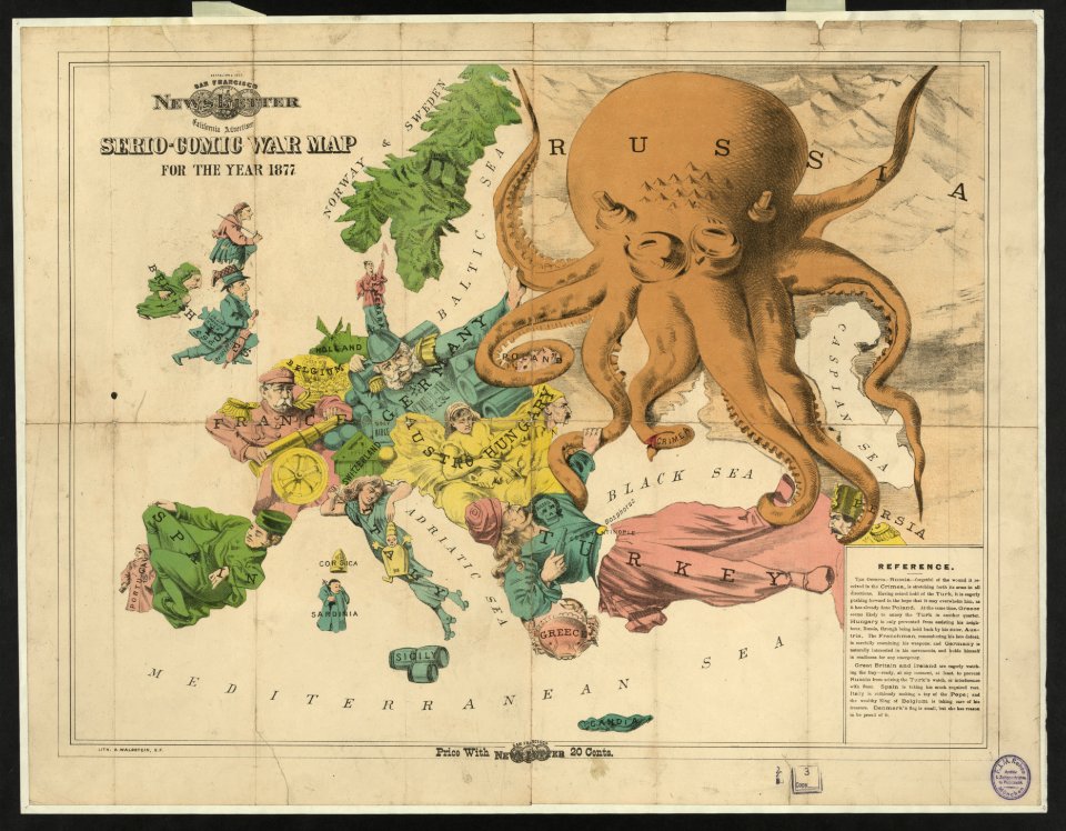
19th-century satirical maps
europe in the 1870s
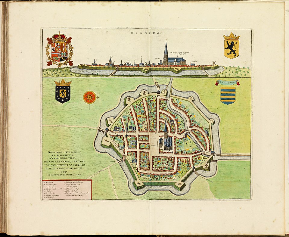
old maps of diksmuide
atlas de wit 1698
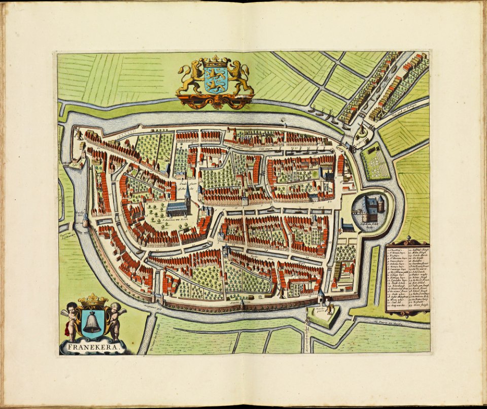
old maps of franeker
atlas de wit 1698
old maps of bourbourg
atlas de wit 1698
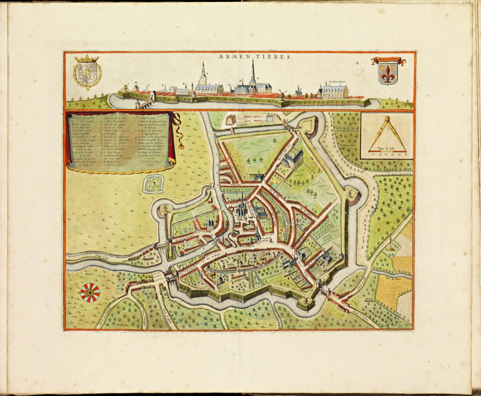
old maps of armentières
atlas de wit 1698
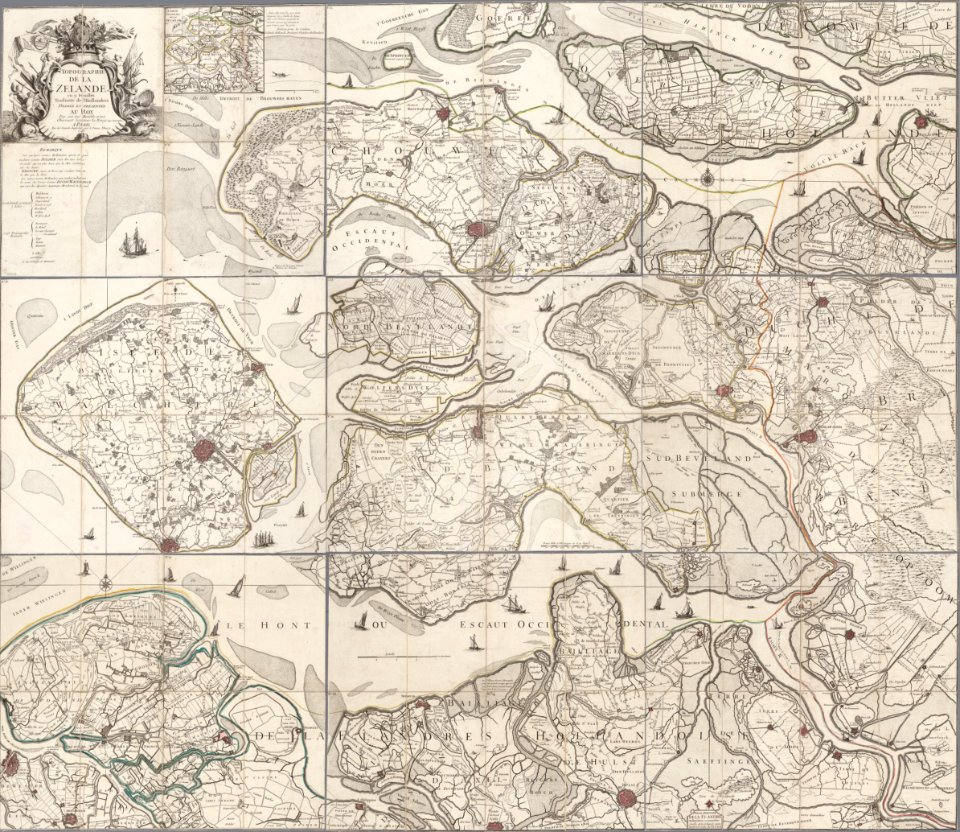
old maps of zeeland
copper engraving
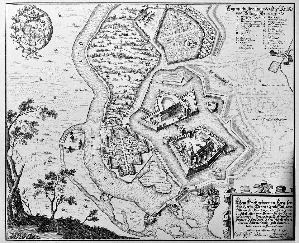
engravings of topographia saxoniae inferioris
maps of bremervörde
braun & hogenberg
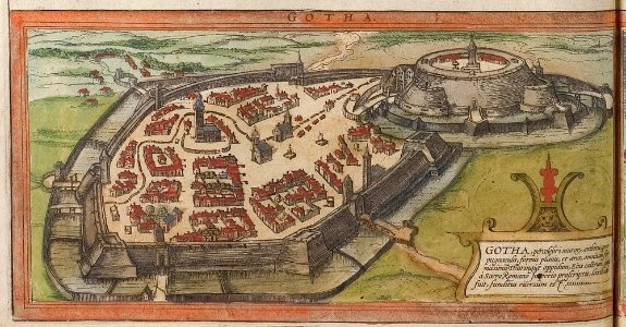
history of gotha
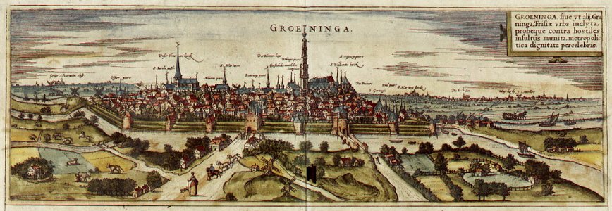
maps of groningen (city) by braun & hogenberg
maps of groningen (city) by braun & hogenberg
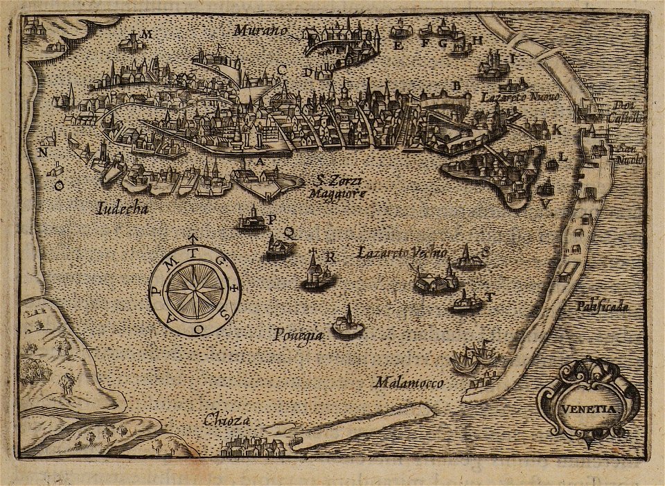
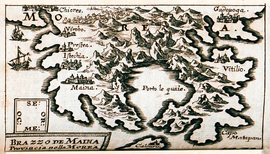
kurtze beschreibung von republick venedig
maps of mani
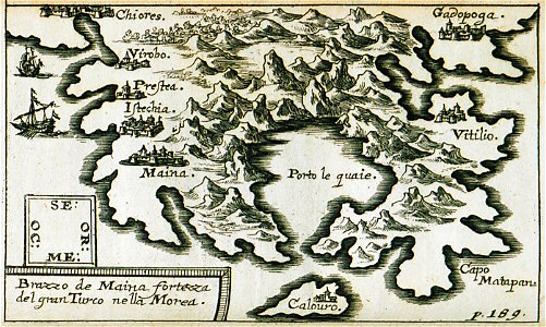
kurtze beschreibung von republick venedig
maps of mani
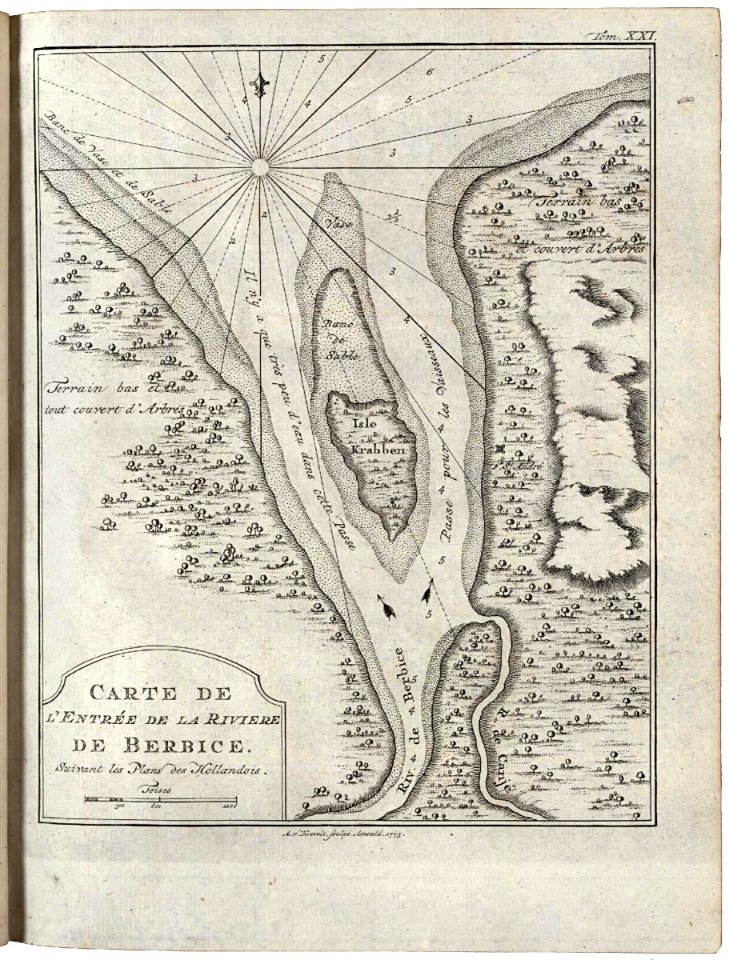
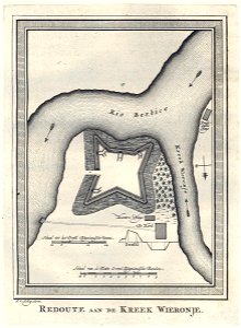
maps of the west-indische compagnie
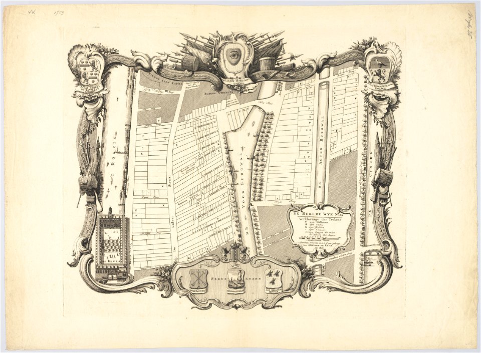
1773
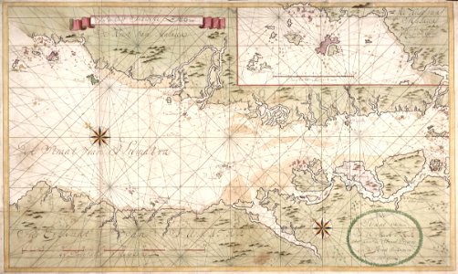
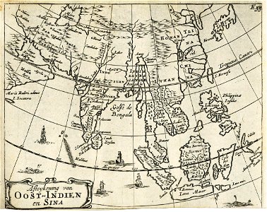
maps of the dutch east india company - indonesia
maps of the dutch east india company - indonesia
old maps of the dutch east india company
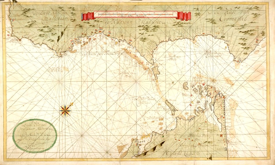
maps of the dutch east india company - india
maps of the west-indische compagnie
1770
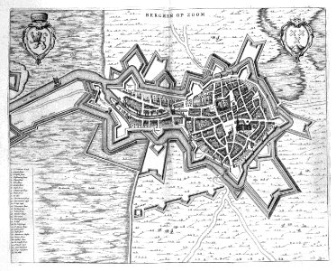
old maps of bergen op zoom
atlas beudeker
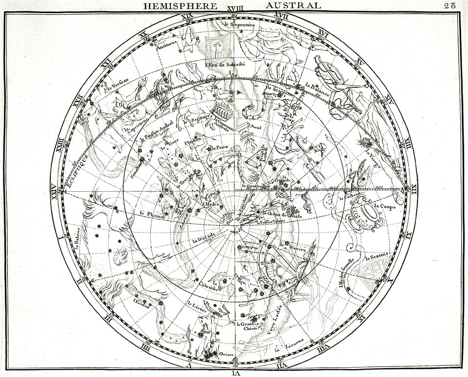
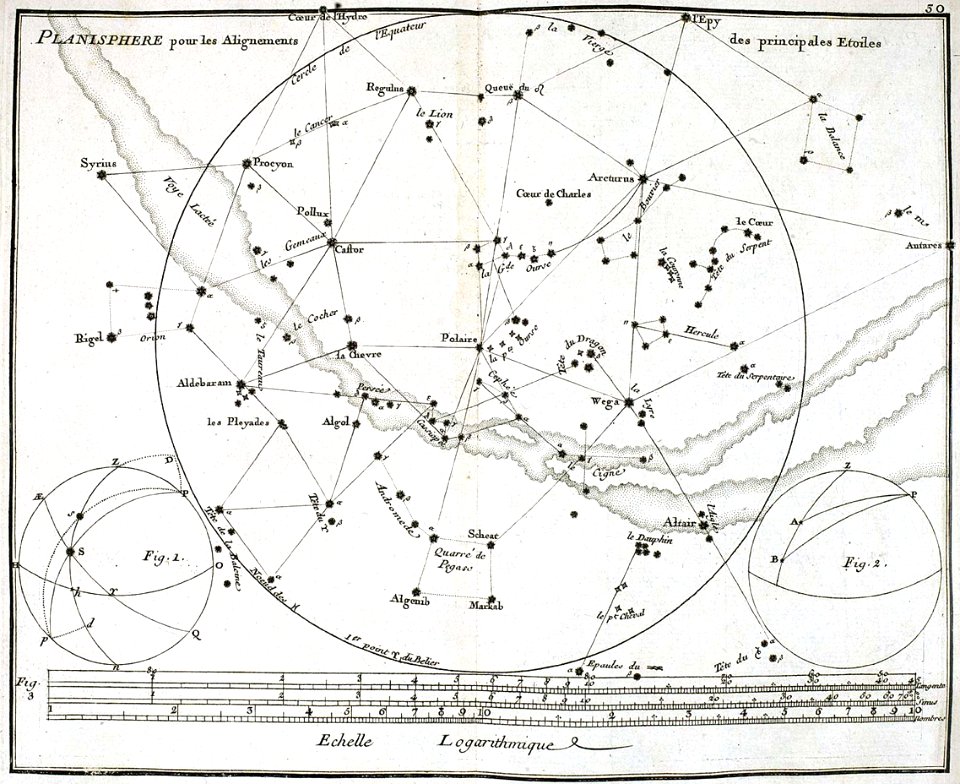
atlas coelestis by john flamsteed
old celestial maps
atlas coelestis by john flamsteed
old constellation maps
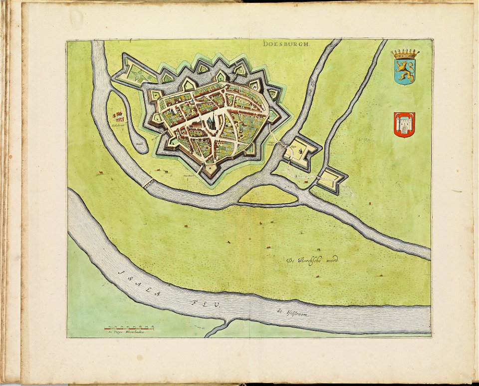
old maps of doesburg
atlas de wit 1698
6601 - 6700 of 35,787
Next page
/ 358